Prof. Zachary Colbert awarded SSHRC grant for utility towns research
October 14, 2025
Associate Professor Zachary Colbert has been awarded a grant from the Social Sciences and Humanities Research Council (SSHRC) to study the spatial, political, and ecological impact of towns in the Colorado Plateau that are based on resource extraction.
The two-year, $72,210 SSHRC Insight Development Grant is for a project titled Architectures of Hegemony: Utility Towns and Distributed Justice in the Colorado Plateau’s Infrastructural Landscape.
“I grew up in this part of the world and have family ties here, so these questions have been on my mind for some time,” says Colbert, the principal investigator of the study.
“The insights generated will contribute to broader work on environmental justice, restorative justice, and the transformation of extractive landscapes into sites of renewal across the Southwestern U.S. and beyond.”
The Colorado Plateau is a large region encompassing parts of Arizona, Utah, Colorado, and New Mexico that has been home to many Indigenous cultures across thousands of years. It is known for its natural beauty and dramatic landscapes, including geologic wonders like the Grand Canyon.
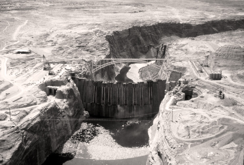
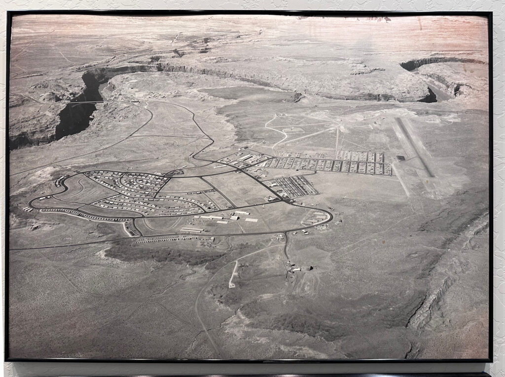
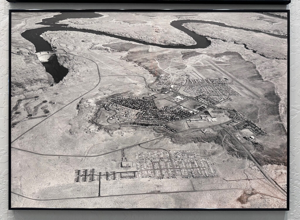
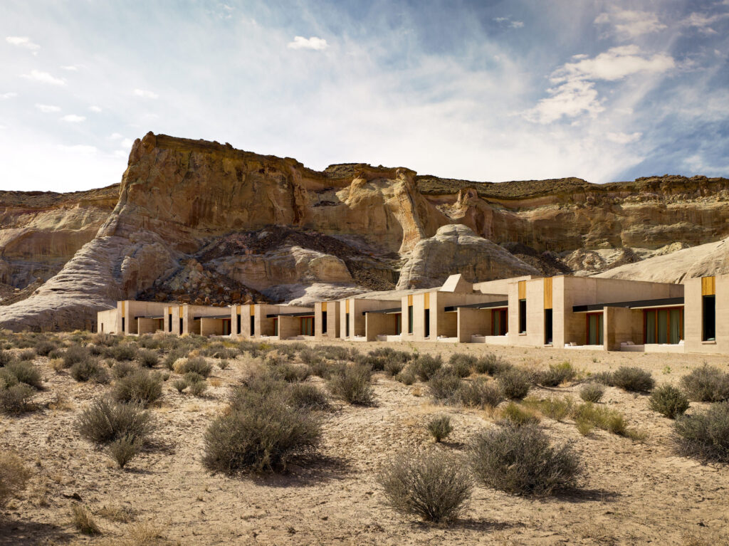
It is also home to a network of utility towns — settlements established to support extractive operations such as dams, power plants, mines, and tourism based on geological features, known as geotourism.
“This research seeks to uncover and interpret the architectures of hegemony — the built forms and spatial practices that sustain extractive systems and their labour forces, reflecting federal priorities while imposing control over land, communities, and Indigenous sovereignties,” explains Colbert.
“Yet, alongside critique, the project also asks how these places might be reimagined toward more just and sustainable futures.”
Colbert’s research examines how the town of Page, Arizona was designed and built to support the infrastructure that delivers water and electricity to cities in Arizona and California, and how these systems shape the land, communities, and daily life in the region.
“I’m primarily interested in understanding how the urban form of these towns developed alongside the infrastructures that sustain the dominant culture of the Southwestern U.S., and how, in turn, the towns themselves reinforce and maintain that culture,” he says.
Tourist infrastructure such as hotels, restaurants, recreation facilities, and service-oriented buildings “exert new forms of spatial and narrative control over the landscape, mirroring the influence of dams, mines, and power plants,” he adds.
Fieldwork will take place during the summer of 2026, in collaboration with researchers at the University of Arizona. This will include interviews and design sessions that engage with Diné communities on the Navajo Nation and in Page.
The research will generate GIS-based maps and a catalog of “architectures of hegemony.” The catalog will document not only large-scale infrastructures — such as dams, power plants, tourist facilities, and administrative structures — but also spatial practices, urban conditions, and the everyday ephemera of the built environment that reproduce or challenge hegemonic power.
“By integrating mixed methods — GIS mapping and participatory engagement — the project develops a replicable framework for studying utility towns in other global contexts,” says Colbert.
“Together, these outputs advance understanding of infrastructure-driven urbanism, environmental justice, and the spatial manifestations of colonial and extractive power.”
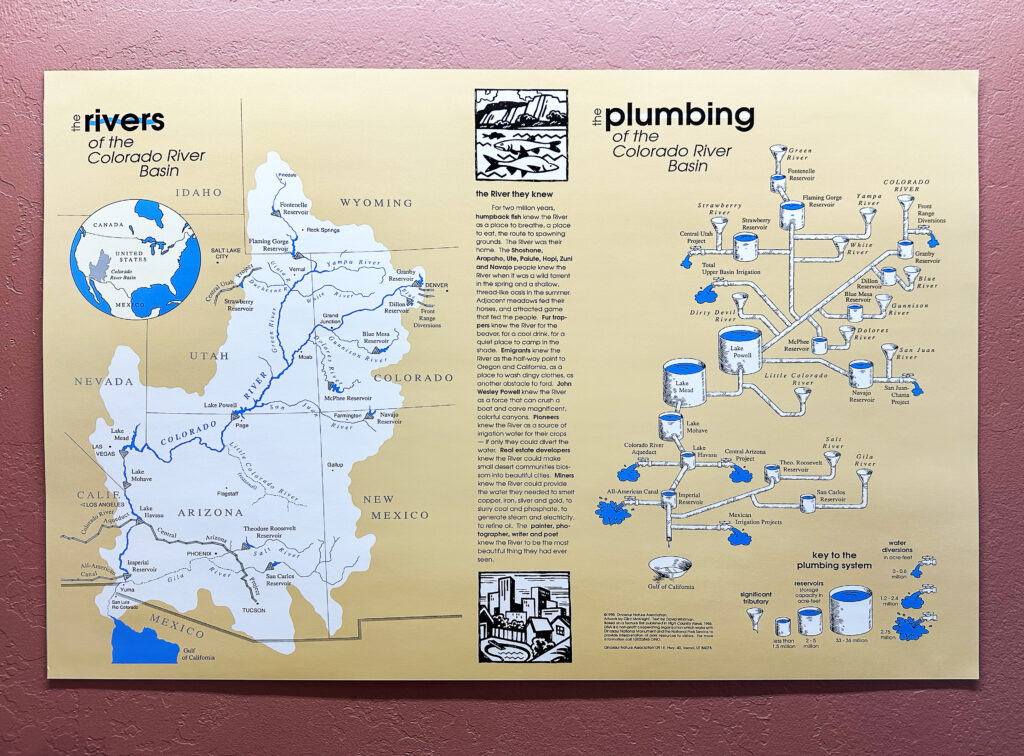
This project builds on other recent research projects examining the Law of the River, which commodifies every drop of water in the Colorado River and has shaped the dominant social, political, and environmental order of the Southwestern U.S.